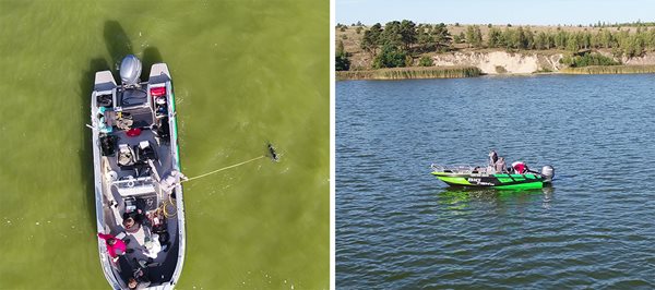
The Curonian Lagoon is a large, shallow predominantly freshwater ecosystem separated from the Baltic Sea by a thin spit of land. With a mean depth of 3.8 metres and surface area of 1,584 km2, the lagoon receives major inflows from the Nemunas River. This provides vital water, nutrients, and unfortunately persistent pollution.
Cyanobacterial blooms frequently dominate the hypereutrophic lagoon in summer months. Fishing has traditionally underpinned the local economy, along with growing tourism, ports, and agriculture.
As with many transitional waters, preserving the Curonian amid intensifying human pressures requires effective, evidence-based management. Monitoring water quality is key for sustaining biodiversity, safe recreation, and livelihoods tied to this dynamic ecosystem.
CERTO in the Curonian Lagoon
CERTO advanced water quality monitoring and knowledge of the Curonian Lagoon by combining fieldwork and satellite data with different spatial and spectral resolutions.
In situ water quality data provided validation for satellite-derived products, giving insights into phytoplankton biomass, suspended solids, and overall aquatic health. Tailored CERTO indicators help support EU policy and monitoring needs, including phytoplankton bloom biomass and bloom maps and a Social-Ecological System Vulnerability Index.
Multi-source satellite data enabled the estimation of phytoplankton seasonal and spatial dynamics concentration. These products contribute to the knowledge and safeguarding of the lagoon functionality services.
CERTO also supports monitoring operations for the evaluation of Good Environmental Status as well as the enhancement of eutrophication indices and phytoplankton phenology.

CERTO fieldwork in the Curonian Lagoon, September 2020